
Popular Categories
 Appliances
 Agri Inputs
 Auto Components & Accessories
 Beauty & Personal Care
 Electronics
 Food & Beverages
 Fashion
 Grocery
 Gift Cards
 Home & kitchen
 Health & Wellness
 Vehicles & Automotives
 Books & Stationary
 Toys & Games
Support
 Contact Us
Language
Our apps


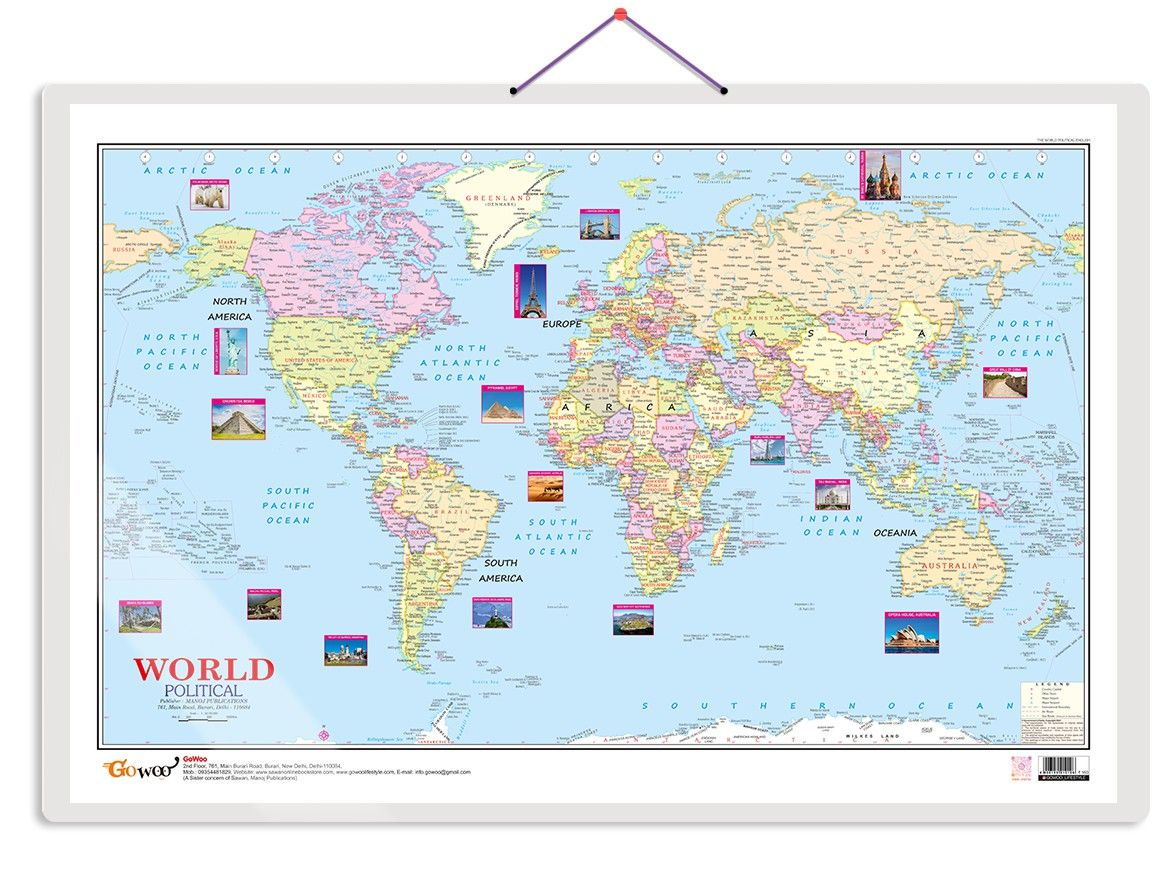
World Political Map Educational Charts | 20"X30" inch |Non-Tearable and Waterproof | Double Sided Laminated |Useful For Preparation Of SSC, UPSC, RRB, IES, and other exams
1 unit
₹159
MRP ₹160
Sold By:
GOWOO
10.1 km
| Country of origin | India |
|---|---|
| Common name | Political Map |
| Net Quantity | 1 unit |
| Manufacturer or packer name | SURAJ SHARMA |
| Manufacturer or packer address | 761 MAIN ROAD BURARI DELHI |
| Manufacturing Date | Oct-95 |
| ISBN | 9788369710 |
| contact details consumer care | GOWOO, [email protected], +919205981829 |
The World Political Map chart is a valuable educational resource for various purposes, including homeschooling. Measuring 20x30 inches, this chart provides a comprehensive view of the global political divisions.
The chart features a detailed political map showcasing countries, capitals, major cities, and boundaries. It offers a clear and accurate representation of the world's political landscape, allowing individuals to better understand global geography and international relations.
Whether used in classrooms, homeschooling environments, or as a reference tool at home, this chart is an essential resource for students, educators, researchers, and anyone interested in exploring and studying the political dynamics of the world.
With its large size, vibrant colours, and transparent labelling, the World Political Map chart is visually appealing and easy to comprehend. It provides a valuable visual aid for discussions, lessons, and general knowledge about the countries and territories that comprise our diverse planet.
The World Political Map chart is a durable and reliable resource that offers an engaging and informative view of the world's political divisions. It is a must-have tool for anyone seeking to expand their knowledge of global geography and understand the intricacies of the world's political boundaries.

Sold By
GOWOO
Not Cancellable
Not Returnable


 Early Learning Educational Chart for Kids | 20\"X30\" inch |Non-Tearable and Waterproof | Double Sided Laminated | Perfect for Homeschooling, Kindergarten and Nursery Students")


